Developing a Contemporary Hollister Ranch Coastal Access Program

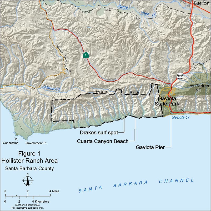
Location of Hollister Ranch
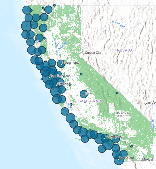
The Hollister Ranch is a 14,500-acre subdivision that includes 8.5 miles of publicly owned shoreline along the Santa Barbara Channel, in Santa Barbara County, with no land-based coastal access for the public. The Gaviota Coast, of which Hollister Ranch is a significant part, is the least accessible stretch of coast in California, with less than 2 miles of publicly accessible shore in more than 60 miles of coastline.
The staffs of the California Coastal Commission, California Department of Parks and Recreation, State Lands Commission and State Coastal Conservancy have entered into an interagency Collaboration Agreement to further the State of California’s public policy of responsibly expanding and enhancing the public’s access to and along the coast and the public’s cultural, educational and recreational experiences at the Ranch.
Working together, these four state agencies have initiated a public access planning process. The initial goals of this process include: 1) engaging a wide variety of stakeholders in a collaborative planning process; 2) developing an over-arching shared vision for public access at Hollister Ranch that will guide development and implementation of the program; 3) ensuring that the vision and program provide for diverse, equitable, and inclusive access that meets the needs, interests and concerns of as broad a range of Californians as possible; and 4) developing a program that can be feasibly implemented in light of the property’s physical and environmental characteristics, regulatory requirements, private property interests, public safety and other identified constraints and interests.
At its October 17, 2019 meeting, the Coastal Conservancy Board approved a staff recommendation to allow use of $300,000 provided to the Conservancy by State Parks for the collaborative planning effort.
If you would like to be included on the email list for the planning process, please send an email to Trish Chapman.
For additional information, please also see the Coastal Commission’s Hollister Ranch website.
Coastal Conservancy Request for Qualifications – Cultural and Tribal Resources Survey and Assessment of the Draft Hollister Ranch Coastal Access Program
The California State Coastal Conservancy (SCC) is seeking qualifications for potential cultural resources/archaeological services contractors to prepare a Cultural and Tribal Resource Technical Report (Technical Report) of the draft Hollister Ranch Coastal Access Program (HRCAP). The scope of work for the Technical Report is to:
1) undertake a cultural and tribal resource survey for the draft HRCAP project area;
2) prepare an ethnographic study; and
3) prepare a report that can be used to complete the existing conditions and impact assessment sections of a Programmatic Environmental Impact Report (PEIR) on the HRCAP. The PEIR will be prepared under a separate contract with the State Lands Commission.
The work will be completed with oversight from SCC, the California Coastal Commission (“CCC”), the State Lands Commission (“SLC”), and the California Department of Parks and Recreation (“DPR”) (collectively referred to as the “State Agency Team” or “SAT”), and representatives from the four Chumash tribes that participate in the HRCAP Chumash Tribal Working Group (CTWG).
SCC’s process of selection for this proposal will follow SCC’s environmental services contracting process, in which SCC solicits a list of contractors referenced by area of specialization, evaluates applications, and then makes a final decision based on demonstrated competence and qualifications. The SAT and CTWG will aid SCC in its evaluation of the applications. SCC will negotiate and manage this contract on behalf of the SAT and CTWG.
Respondents to this Request for Qualifications must submit the information requested below electronically in Microsoft Word or PDF format to: trish.chapman@scc.ca.gov on or before 5:00 p.m. on November 21, 2022. Please limit total file size below 20 MB.
More information can be found in the full RFQ here.
Please email Trish Chapman with questions. Further information on the RFQ will be posted on this website.
Questions and Answers
Q1 Can we get the shape files for the conceptual plans from Appendix A of the draft HRCAP?
A1 Yes, they are available here. The updated disturbance areas will be larger because they include buffer areas.
A1 Update Updated maps of the conceptual design areas of potential effect can be downloaded here. The maps are available in both shapefile and kmz format.
Q2 The RFQ states that the “survey … will focus on six potential public beaches …(see Attachment 2 for site maps).” The maps in Attachment 2 depict a teal-colored line that appears to go from Agua Caliente beach to San Augustine beach. Can you confirm that the APE includes the entire beach area highlighted by the teal line? If not, what is the extent of the APE in each beach area?
A2 No, the teal line represents the area below mean high tide that is public beach. The six potential site maps were inadvertently left out of the RFQ. The current site plans are found in Appendix A of the Draft HRCAP. The updated site maps, including trail impact area maps, can be downloaded here.
Q3 Is updating site records recorded on pre-1995 DPR forms (regardless of whether there is a boundary change) part of the scope of work?
A3 Updates to existing site forms are required only when substantive changes to their boundaries, contents or condition warrants their update. Such updates should be done on current DPR forms. If there are no substantive changes to the resource recordation, then no update to the form will be required.
Q4 Can you confirm the contract start and end dates and work completion dates as dates are stated variously in the RFQ Section 4.2 Key Dates and Attachment 3?
A4 The start and end dates in the RFQ are estimates. The start date in the RFQ is the date by which we think the State contract can be executed and approved by all required State entities. If this process takes longer than expected, the start date will be later. If the process moves more quickly, the start date can be earlier. The work completion date in the RFQ is negotiable but must be compatible with the concurrent CEQA process.
Q5 For smaller subcontractors will the Conservancy accept reduced general liability coverage of $1 million rather than $2 million?
A5 The general liability coverage for subcontractors can be negotiated. In most cases we will agree to $1 million rather than $2 million.
Q6 Concerning the survey area, is there a set buffer distance around the potential project areas (parking, access routes)?
A6 Each area of potential effect (APOE) has been ranked based on the level of development and potential impacts for that area and has been given a buffer of some distance. All of this is captured on the new site plans found here.
- Areas with a rank of 1 are those that will have no physical change but may have secondary impacts from noise or visitors straying from outside improved areas. These areas generally have a buffer of 50′ from the edge of access improvements (outside of improved areas).
- Areas with a rank of 2 will receive only surface changes, such as an improved decomposed granite or asphalt surface, or minor shade, seating, or signage amenities. Areas with a rank of 2 are wholly within potential improved areas.
- Areas with a rank of 3 may have new structures that require excavation such as waterless toilets that require excavating for a vault. In the site design, these have been placed furthest away from the beach. A rank of 3 also includes the potential for grade-separated crossings at all but the first two beaches (excludes the two eastern beaches, Agua Caliente and Alegria). Areas with a rank of 3 are wholly within potential improved areas.
- Areas with a rank of 4 are construction buffers. Generally, a 5′ buffer is given around the outside edge of areas ranked with a 2 (due to lighter construction equipment/ methods needed), and a 10′ buffer is given around the outside edge of areas ranked with a 3 (due to larger construction equipment needed).
Potential trail access routes and any necessary retaining walls have been given a buffer around the centerline of the feature alignment.
- For bike lanes (positioned at the edge of the road), a 3′ buffer has been used.
- For a hiking trail (positioned both at the edge of the road and away from the road), a 5′ buffer has been used.
- For a multiuse path (positioned both at the edge of the road and away from the road), a 7′ buffer has been used.
Retaining walls have been mapped where they are necessary to support the alignment of a bike lane, hiking trail, or multiuse path. Steeper slopes require taller retaining walls regardless of the type of trail facility and have been categorized as short (30″ or shorter), medium (30″ – 6′), tall (greater than 6′, though not exceeding 9′), and terraced walls (treated as two medium walls).
Regardless of the type of trail facility, the following additional buffers have been applied to retaining walls:
- Short walls: 3′ buffer
- Medium walls: 5′ buffer
- Tall walls: 7′ buffer
- Terrace walls: 5′ buffer
The buffer from the trail centerline + the retaining wall buffer (where applicable) = AOPE for trail alignments
Q7 Will existing roads leading off Rancho Real Road into the access locations be repaved or expanded?
A7 Repaving is likely for existing access roads leading off of Rancho Real Road. These roads have been given an AOPE rank of 2 and a 5′ construction buffer (rank of 4). Where access roads cross the railroad tracks at-grade, road expansion may be necessary to include a full travel lane in each direction, if it is determined that the railroad crossings need to meet public crossing standards (CPUC requires a full travel lane in each direction at public crossings, though the required length of road with 2 lanes is unknown).
Latest News
- Press Release: Coastal Conservancy Awards over $40 million for coastal access, restoration, and climate resilienceOakland, CA (4/18/2024) – Today, the Board of the State Coastal Conservancy approved grants totaling over $40 million for coastal access, restoration, and climate resilience. Among the grants awarded today are: A grant of up to $6,000,000 to Humboldt County Resource Conservation District to undertake the North Coast Wildfire Resilience Planning and Implementation Grant Program, which […] (Read more on Press Release: Coastal...)
- Sea Otter Recovery Grants RFP Now Open!The California State Coastal Conservancy announces the availability of grants to public agencies, tribes and nonprofit organizations for projects that facilitate the recovery of the southern sea otter along California’s coasts. The California Sea Otter Fund is one of the state’s tax check-off funds that allows taxpayers to voluntarily contribute to the recovery of California’s […] (Read more on Sea Otter Recovery...)
- Coastal Conservancy Public Meeting in Oakland – April 18Meeting Notice Douglas Bosco (Public Member), Chair Marce Gutiérrez-Graudiņš (Public Member), Vice Chair Joy Sterling (Public Member) Jeremiah Hallisey (Public Member) Wade Crowfoot, Secretary for Natural Resources; Bryan Cash and Jenn Eckerle (Designated) Caryl Hart, Coastal Commission Chair; Madeline Cavalieri (Designated) Joe Stephenshaw, Director, Department of Finance; Michele Perrault (Designated) Senate Representatives Benjamin Allen (District […] (Read more on Coastal Conservancy Public...)

 Help Save Sea Otters at Tax Time

