Press Release: First California Coastal Trail Map Will Help Complete the 1,230-Mile-Long Trail
Staff Report: https://documents.coastal.ca.gov/reports/2021/5/W6d/W6d-5-2021-report.pdf
Map: https://the-california-coastal-trail-1-coastalcomm.hub.arcgis.com/
Contact: Noaki Schwartz at Noaki.Schwartz@coastal.ca.gov and Taylor Samuelson at Taylor.Samuelson@scc.ca.gov
SAN FRANCISCO _ The Coastal Commission and Coastal Conservancy released a digital map that for the first time shows the existing sections of the California Coastal Trail, a three-year project that will be critical to completing the rest of the trail.
“What a milestone,” said Coastal Commission Executive Director Jack Ainsworth. “There are currently 875 miles of trail and now we can finally see exactly where they are, so we can eventually bridge those gaps and finish the trail.”
The California Coastal Trail, which has been in the planning since 1975, is a network of trails that will eventually allow the public to traverse the length of California’s 1,230-mile-long coast. The varied trail is not a single pathway but a collection of parallel threads and is about 70 percent complete. The trail takes participants through beaches, along blufftops and hillsides, on footpaths, sidewalks and separated bicycle paths maximizing scenic coastal views. Portions of the trail are accessible on foot, bicycle, wheelchair users and on horsebacks as well.
“The California Coastal Trail is one of the only flagship trails in the country that is accessible to almost everyone,” said Coastal Conservancy Executive Officer Sam Schuchat. “Many Californians have walked a segment or two without even realizing it! With this map, people can find trail segments easily, as well as public access points to get to the shore.”
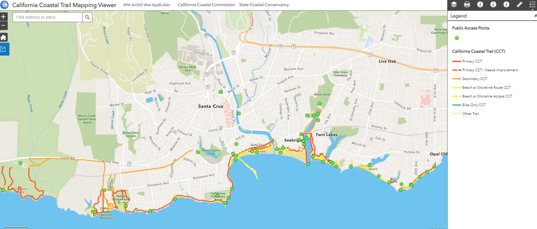
The map will be available for free download and has a variety of uses. Members of the public can use the public access points to plan trips and planners can see where the amenities to help determine other segments. Users can also zoom into trail alignments and see details such as pathways and stairs. The online map will allow members of the public and planners to click on and view the length of the segment, the name, which city its located in and who the trail steward of each section is.
Users can also determine which segments are complete and safe to access, which are problematic, which routes are waterfront, which are bike only segments and where there are significant connecting trails. The project was completed with support and information from Caltrans, State Parks and many other state and local agencies.
“This really going to help the public appreciate all their options for accessing the coast,” said Coastal Commission Vice-Chair Donne Brownsey. “Hopefully we will get more people out there on those beautiful trails.”